
Traffic-sign survey
Every sign in town: where, what and which way it faces.
A traffic-sign survey maps a municipality's signs, poles and road markings as GIS layers. A vehicle with cameras and AI detection drives the streets, and a trained team reviews the images one by one and places every sign on the aerial photo. The result is a digital inventory the local traffic authority can work from.
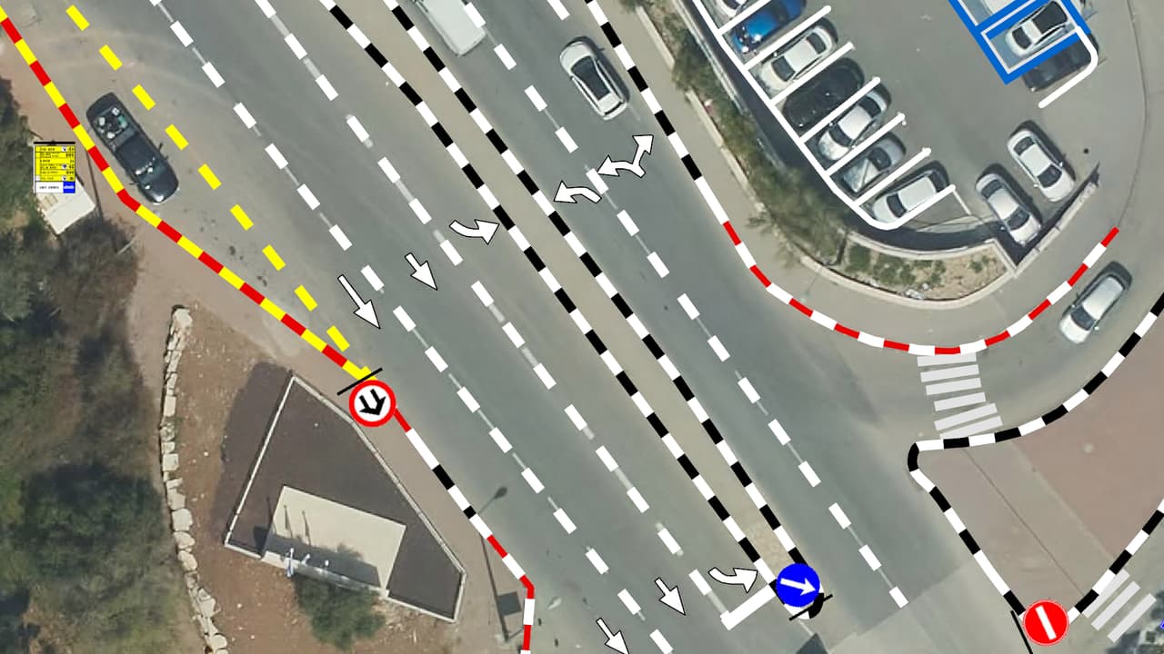
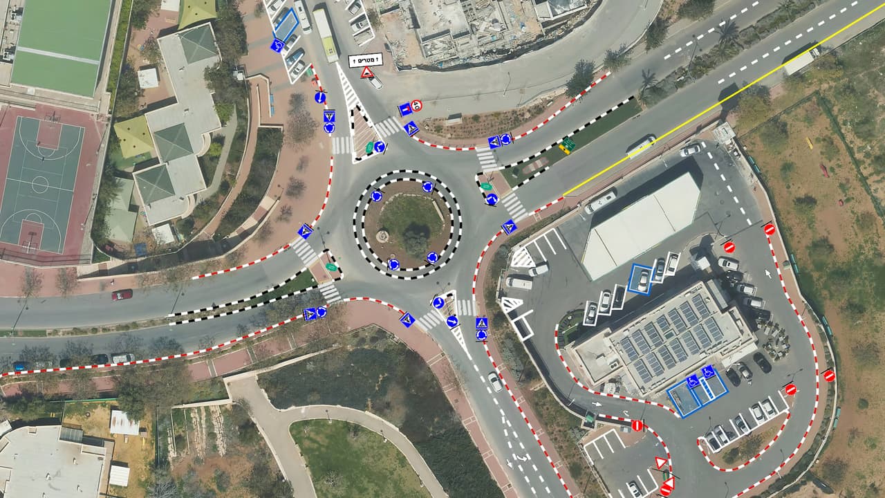
SIGNYX: signs and survey points at a roundabout
What it is
A sign inventory, not a pile of photos
A traffic-sign survey finds and records every sign, pole and road marking in a municipality, with location, sign code, direction and photo, stored as GIS layers.
The local traffic authority is responsible for every sign in its area, and every change to traffic arrangements goes through the traffic committee. Without a current inventory it is hard to know what is actually installed, what matches committee decisions and what needs replacing. The survey gives a complete picture, from which you can manage maintenance, plan changes and prepare material for approvals.
The method
From a drive down the street to a sign on the map
- TAKE 01 · ST-01PlanningWe set the survey boundary, the driving routes and the attribute table: which signs, which markings and which fields.
- TAKE 02 · ST-02Vehicle captureA vehicle with panoramic cameras drives the streets, and AI detection flags signs during the drive. Every stretch of street is kept as imagery.
- TAKE 03 · ST-03Human verificationA trained team reviews the images, confirms each detection, adds anything missed and places every sign on the aerial photo.
- TAKE 04 · ST-04Building layersSigns, poles and road markings become layers coded to the Ministry of Transport sign catalogue and CBS street codes.
- TAKE 05 · ST-05DeliveryThe layers, the street imagery and a traffic and transport app in your ArcGIS Online, ready for the traffic department to use.
The layers
What you receive
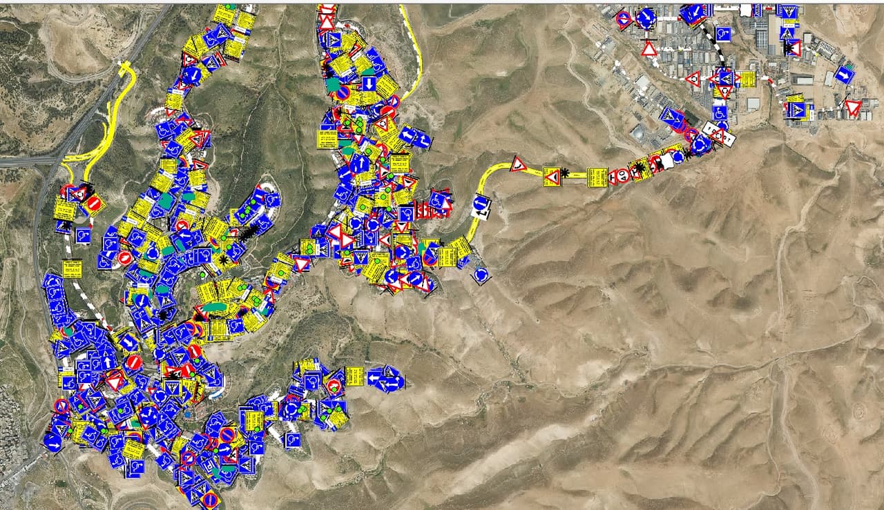
- Pole-mounted signsA point layer: Ministry of Transport sign code, address by CBS street code, direction in degrees, unique ID, pole number and photo.
- PolesA pole layer with coordinates and the number of signs mounted on each pole.
- Road markingsLine and polygon layers: pedestrian crossings, bus stops including accessibility, no-parking zones, speed humps and disabled parking bays.
- Street imageryAll drive imagery is handed over for ongoing use by the traffic, engineering and enforcement departments.
Extensions
Beyond the inventory
- Maps for approvalTraffic-arrangement maps prepared for police and traffic-consultant approval.
- Digitised committee decisionsExisting traffic-committee decisions turned into a layer, and compared with what is installed on the street.
- Condition recordsSign and pole condition recorded against criteria agreed in advance, to prioritise replacement and repair.
- An inventory that stays currentLayers connected to your working system, so every new or removed sign is reflected on the map.
From survey to management
SIGNYX: the inventory the traffic committee works on
SIGNYX is a system for running the traffic committee's work: requests, plans, map-based planning, meetings and decisions in one place. Its ArcGIS edition is in use today at a regional council, and a new web app is in development. The survey's sign inventory is the base layer the committee plans and decides on.
FAQ
Questions about traffic-sign surveys
What does a traffic-sign survey include?
Locating every pole-mounted sign, pole and road marking in the survey area. Each sign gets a catalogue code, an address by street code, a direction in degrees, an ID and a photo. Markings such as crossings, disabled bays and speed humps are delivered as line and polygon layers.
How does the AI detection work, and what if it is wrong?
The in-vehicle system flags signs in the images during the drive. A trained team then reviews the images, confirms or corrects each detection and adds signs that were missed. No sign enters the layer without human verification.
How is each sign positioned on the map?
After image verification, each sign is placed on the municipality's aerial photo and given a direction in degrees. Positions rest on one consistent source, so the layer fits the rest of your GIS.
Does the survey include road markings?
Yes. Crossings, bus stops including accessibility, no-parking zones, speed humps and disabled bays are delivered as line and polygon layers alongside the sign layer.
Are the results suitable for the traffic committee and approvals?
Layers follow the official sign catalogue codes, and traffic-arrangement maps for police and traffic-consultant approval can be produced from them. Existing committee decisions can also be digitised and compared with what is on the street.
How does the survey relate to SIGNYX?
The survey produces the sign inventory. SIGNYX is the system where the traffic committee manages requests, plans, meetings and decisions on top of that inventory. You can order a survey without SIGNYX, and the layers go into your own system.
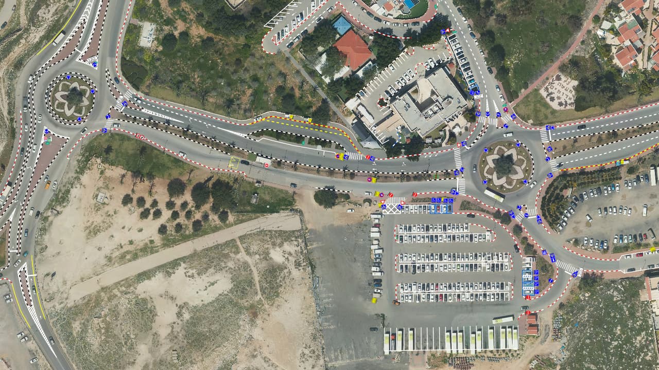
How many signs do you have? Let's count.
Tell us about your area and what already exists, and we will propose a survey that starts with one street or the whole town.