
Projects
From the field, through the layer, into everyday work.
Surveys, systems and software we have built for local authorities, regional councils and public bodies in Israel. Each project shows what needed solving, what we did and what the client can do now. Client names appear only where we have permission to publish them.
A 3D street built from aerial-photo layers
From the field
Work you can see on the map
Each card opens the full story: the challenge, the solution, what was delivered and what the client does with it today. The data strip on each card shows the source, the date and the coordinate system where they are known.
-
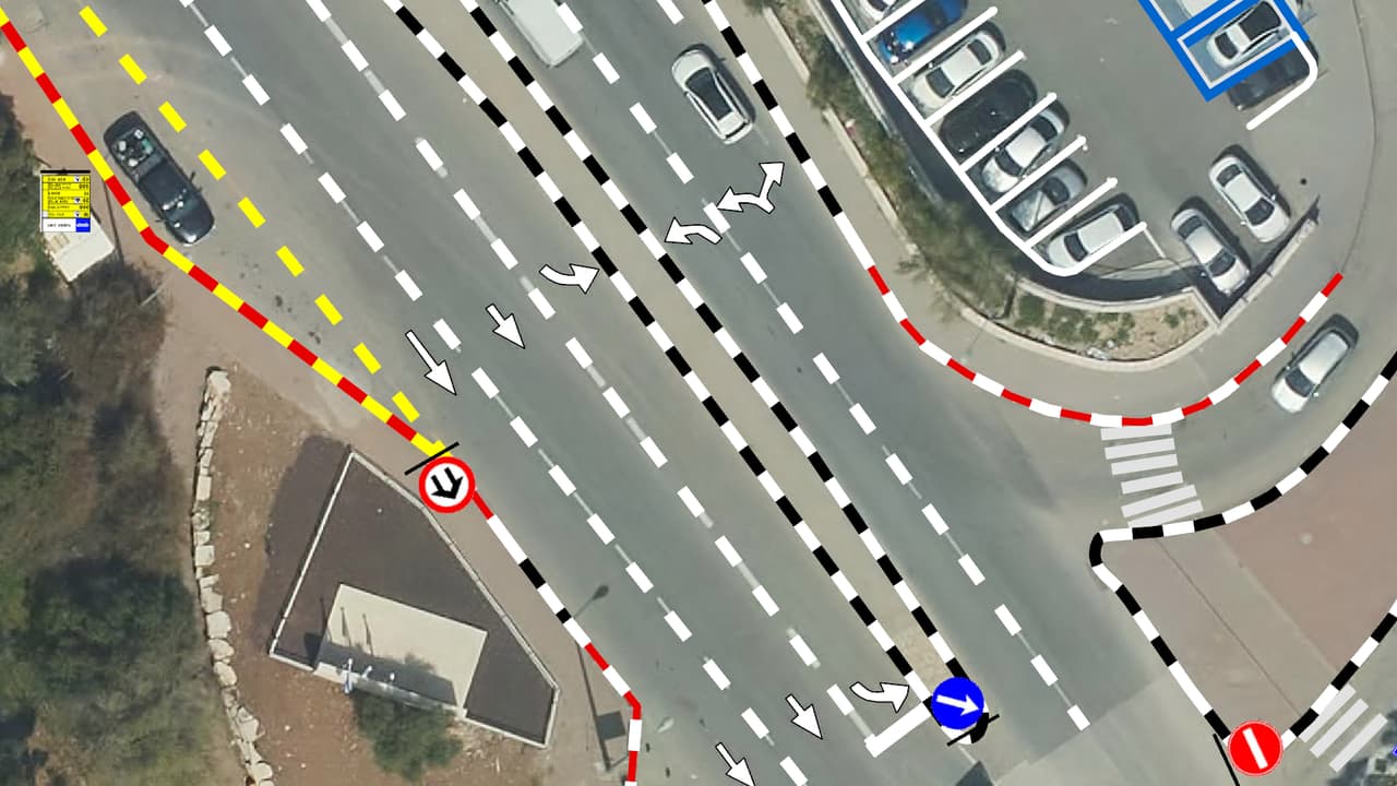
Vehicle survey of traffic signs and road markings
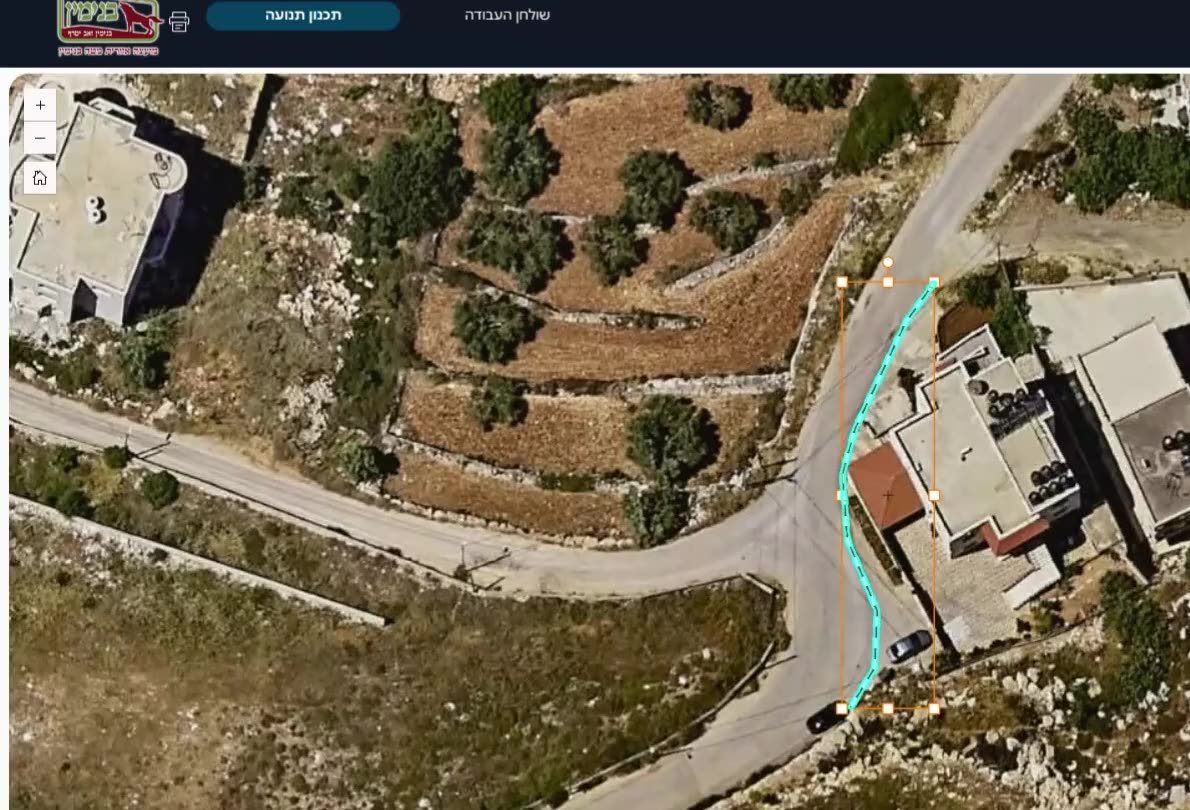
Camera vehicles with on-board AI, a person checking every frame, and every sign placed on the aerial photo: GIS layers of signs, poles and road markings, plus a transport app in ArcGIS Online. -
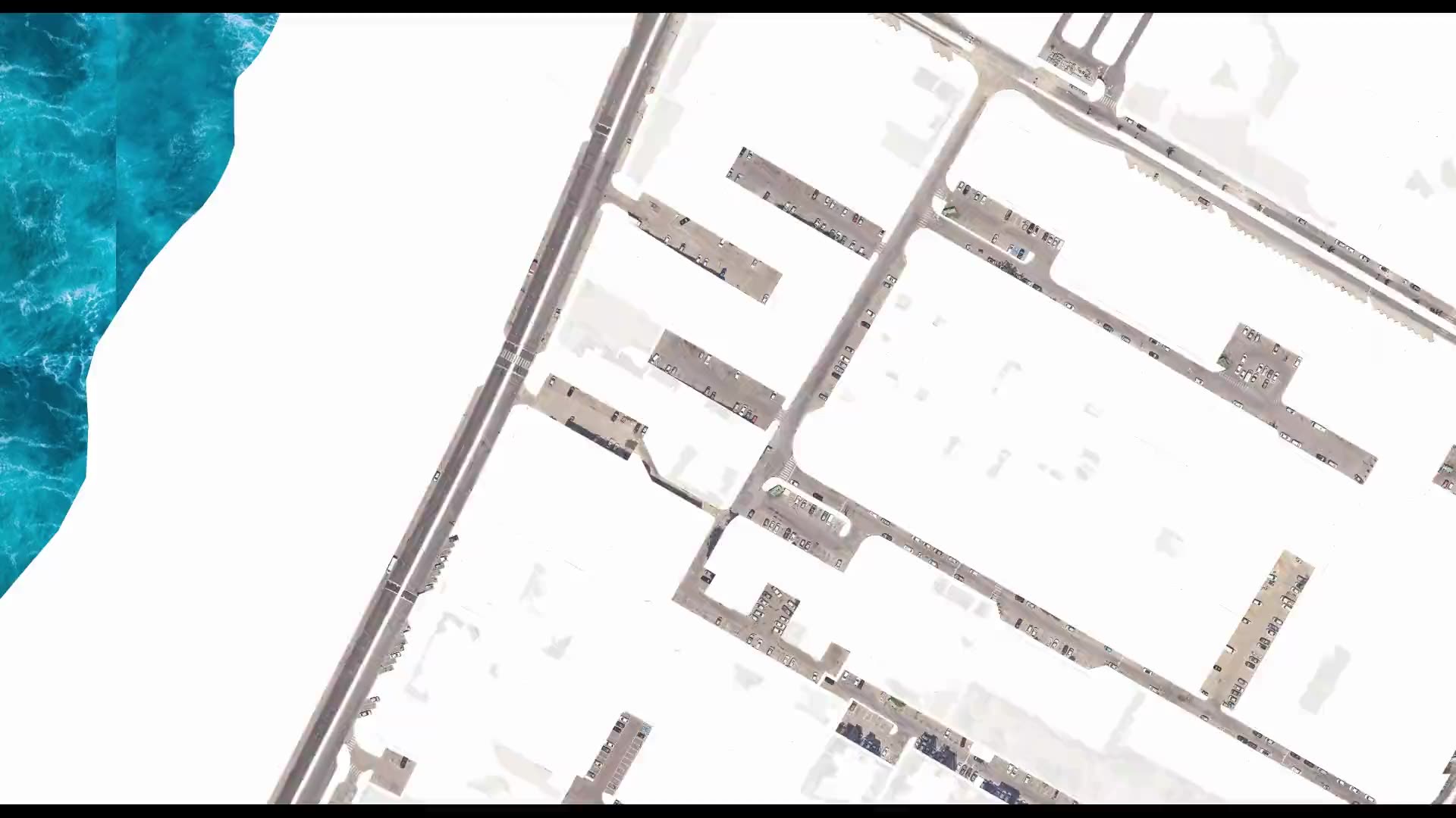
Street-level urban heat-island map – Kiryat Yam
Heat factors coded from the aerial photo, shade computed every half hour, and all of it combined into one shading priority map at the level of streets, paths and bus stops. -
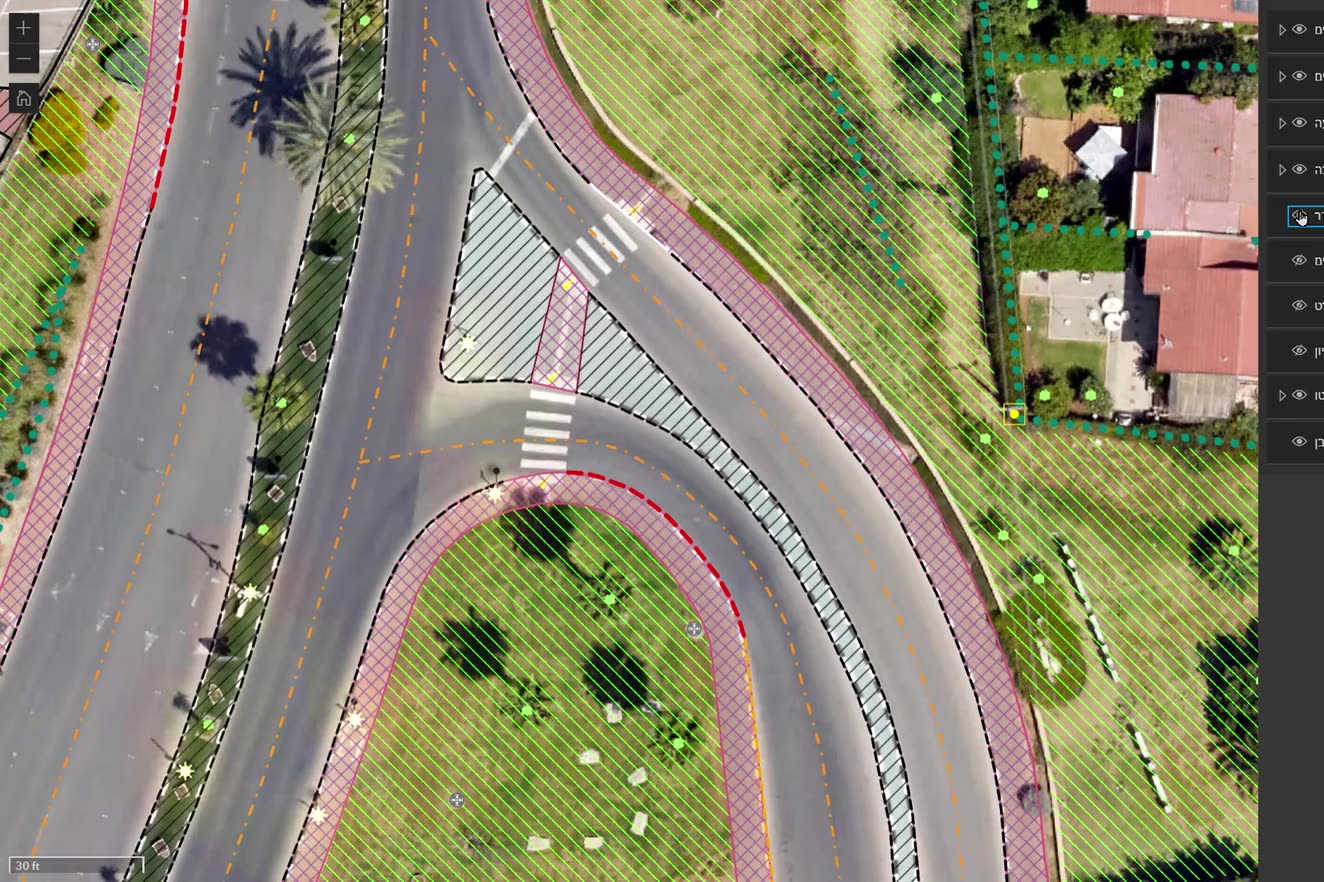
Ortho-graphy: city base layers from an aerial photo
Machine recognition on the authority's own aerial photo, manual completion and full QC: buildings, pavements, drainage, poles, signs, trees and more, with heights, in GIS, DWG and PDF. -
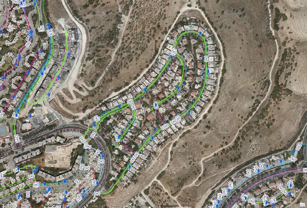
Drainage surveys: inlets, manholes and lines on the map
Urban drainage infrastructure mapped on the aerial photo for two authorities: inlets, manholes, drainage lines and inlet lines, with a city-wide survey map and a dashboard. -
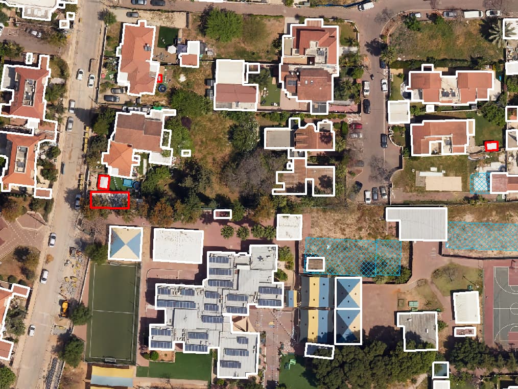
Building-change survey from two aerial photos
Every building coded on an older and a recent aerial photo; new, demolished and enlarged buildings flagged in a prioritised findings report for building inspection. -
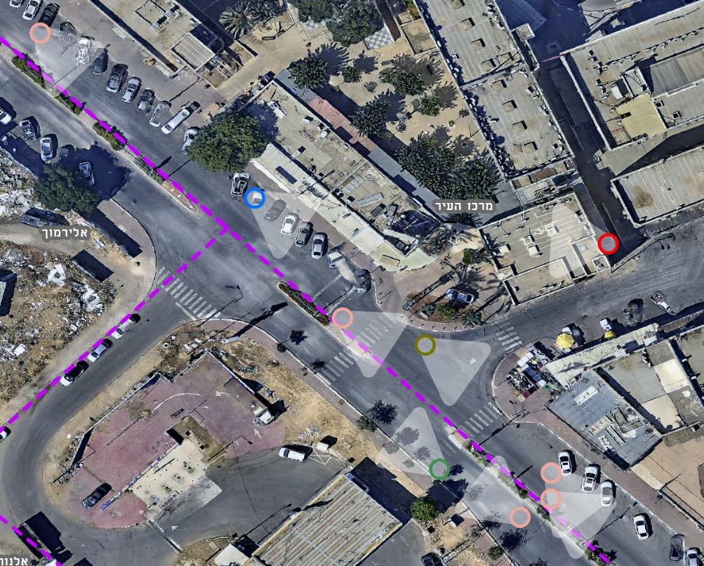
Public-space hazard survey from vehicle imagery
Vehicle imagery and AI detection located hazards on pavements and in public space, each placed as a point in a GIS layer. -
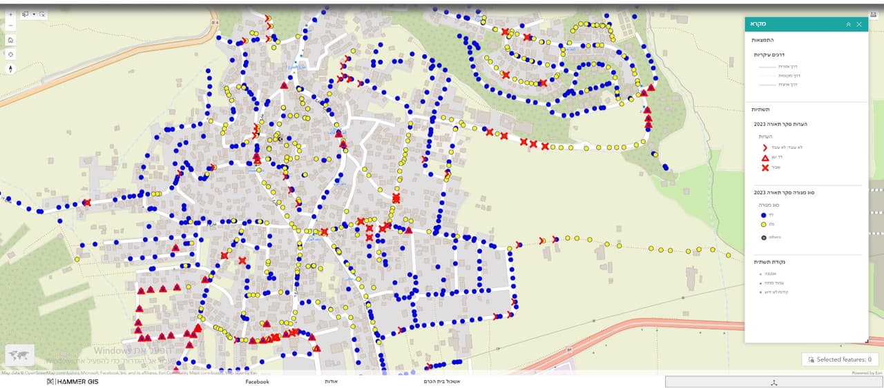
Street-lighting survey and a lighting-management dashboard
Every lighting pole numbered, photographed and recorded by app straight into GIS, linked to its control box, with a lighting-management dashboard. -
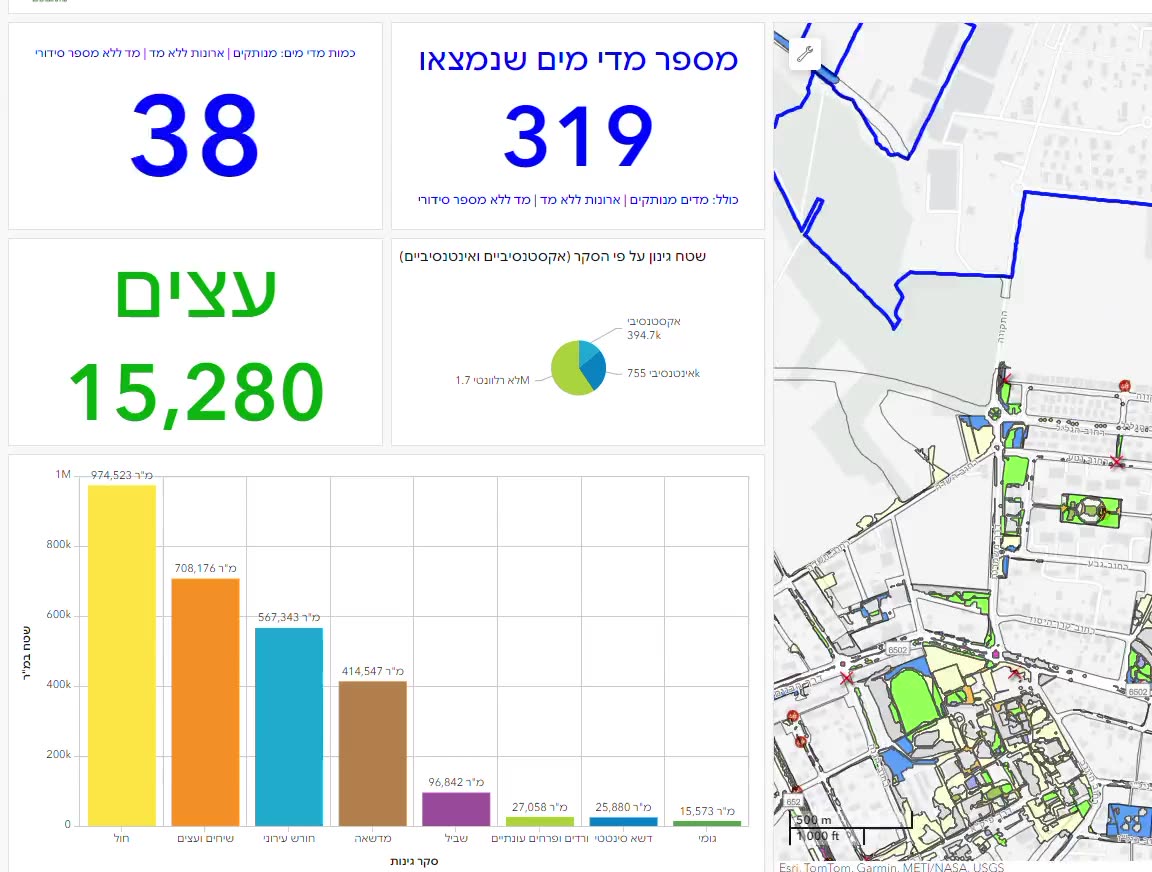
Gardening and water-meter survey with a navigation dashboard
Trees and irrigation water meters in GIS layers, with a dashboard of counters, charts and a map that navigates to any item from a desktop or a phone. -
SIGNYX: a traffic committee that works on the map
A system for a regional council's traffic committee: incoming requests, map-based sign planning, committee meetings, decisions and PDF documents, on the council's ArcGIS Online. -
HAMMER CITY and CADabra: one map for every city department
One map site for every city employee, in Hebrew and in the city's branding, on its own ArcGIS Online, alongside CADabra for turning AutoCAD plans into GIS layers. -
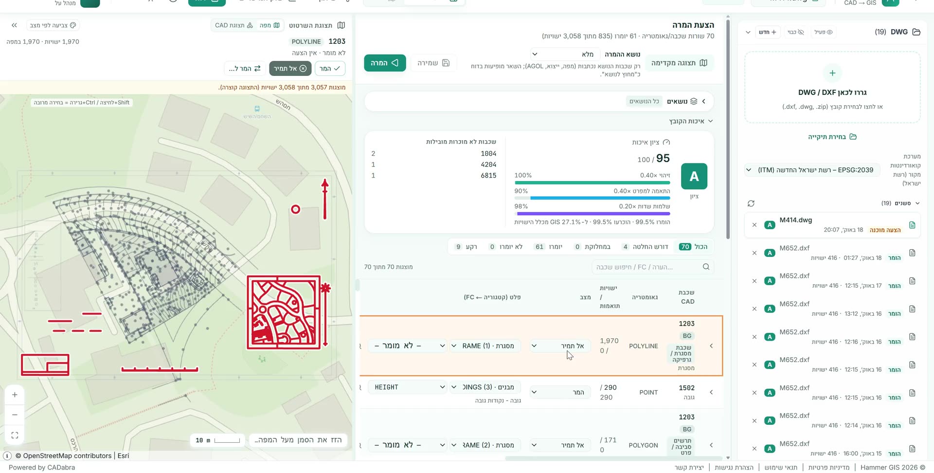
CADabra: a real AS-MADE survey becomes GIS layers
A real survey file converted into GIS layers to the Survey of Israel specification: 99.5% of the data entities identified, grade A, with the coordinate system detected automatically. -
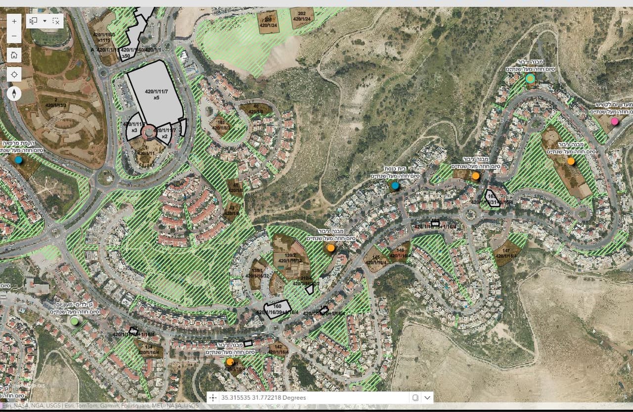
A municipal asset-management app
All of the authority's property on one map: assets, plots, lease contracts and allocations, with an editing map, an editing table, a survey form and an assets dashboard. -
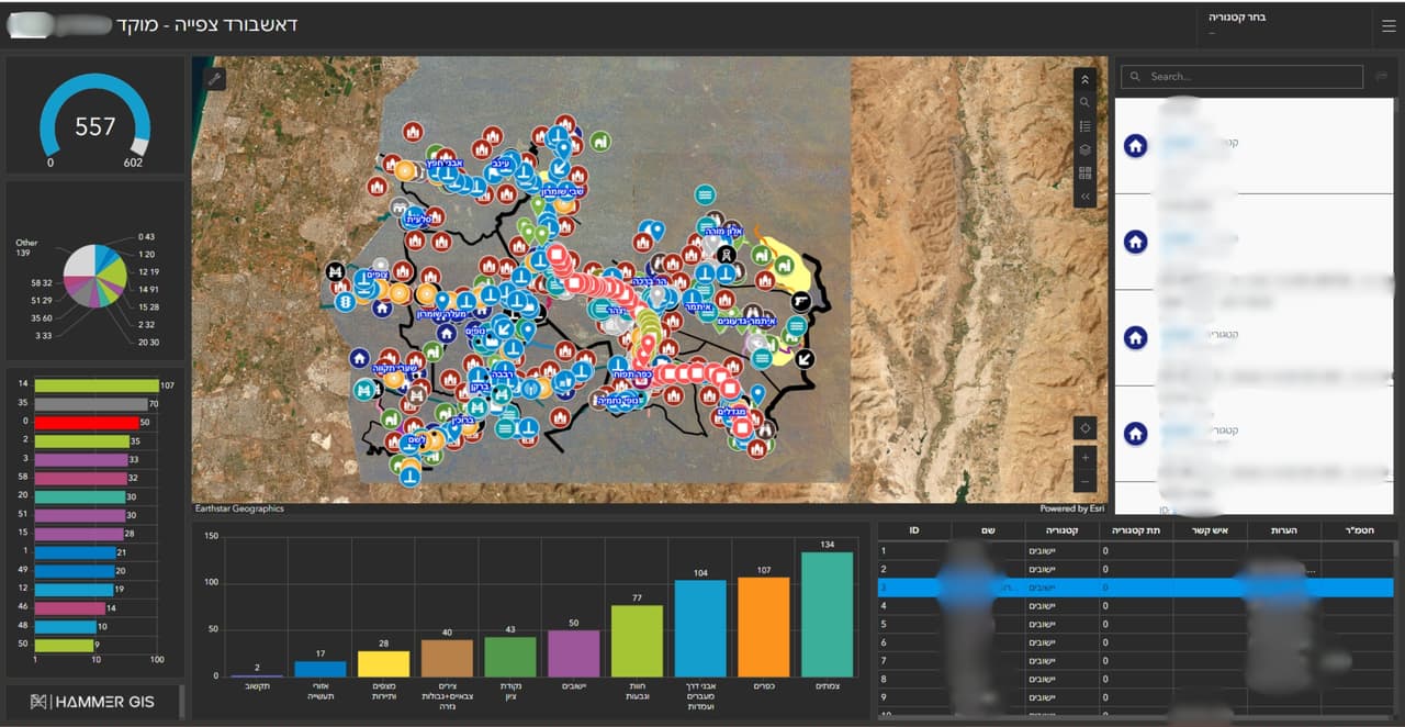
GIS system and call-centre dashboard for a regional council
A GIS system for the council, a call-centre dashboard with a map and charts, and external links that open straight from the map. -
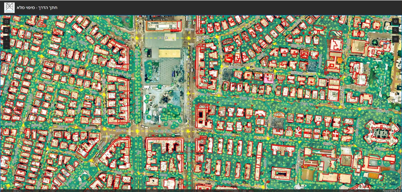
Resident maps: collection days, thematic maps and a road cross-section survey
ArcGIS Online apps for local authorities: waste and pruning collection days by address, comparison and thematic maps for residents, a road cross-section survey and self-survey forms. -
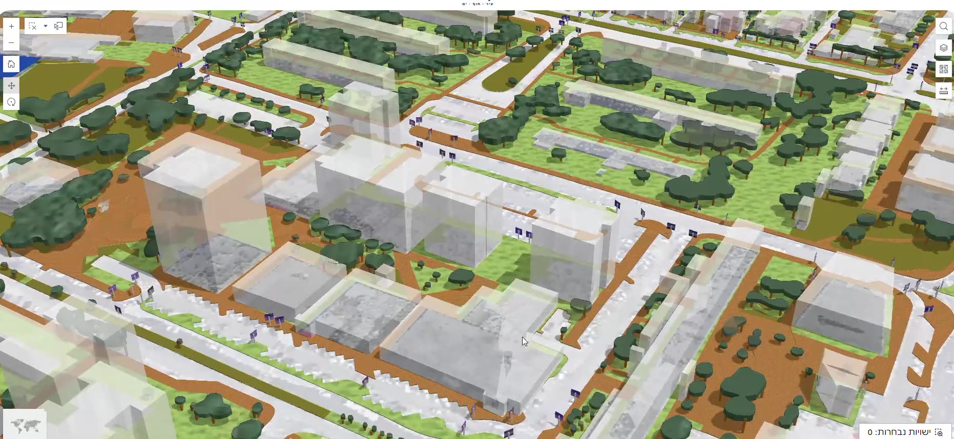
A public GIS and a 3D city scene
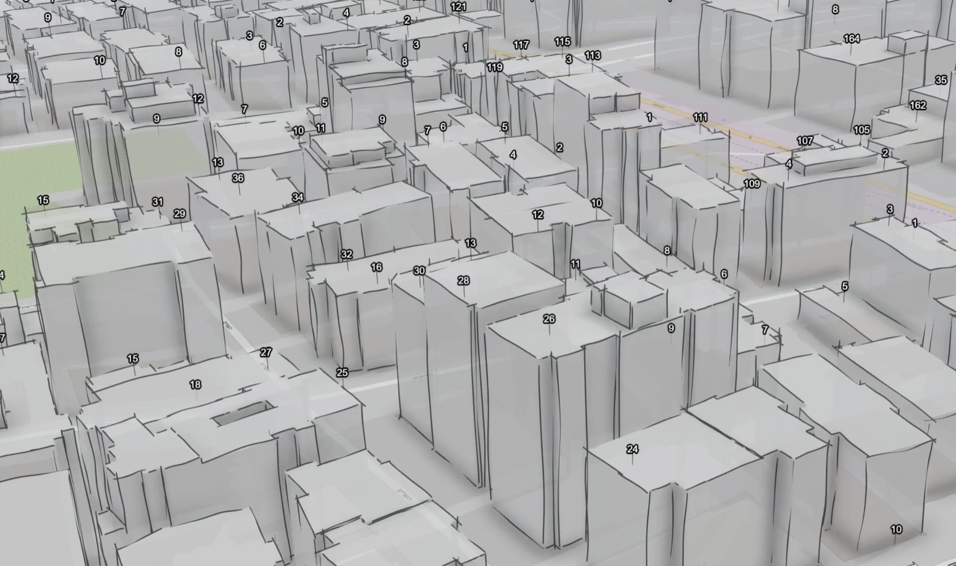
A public GIS for browsing the city's layers, and a 3D scene of the city from the coastline to its towers. -
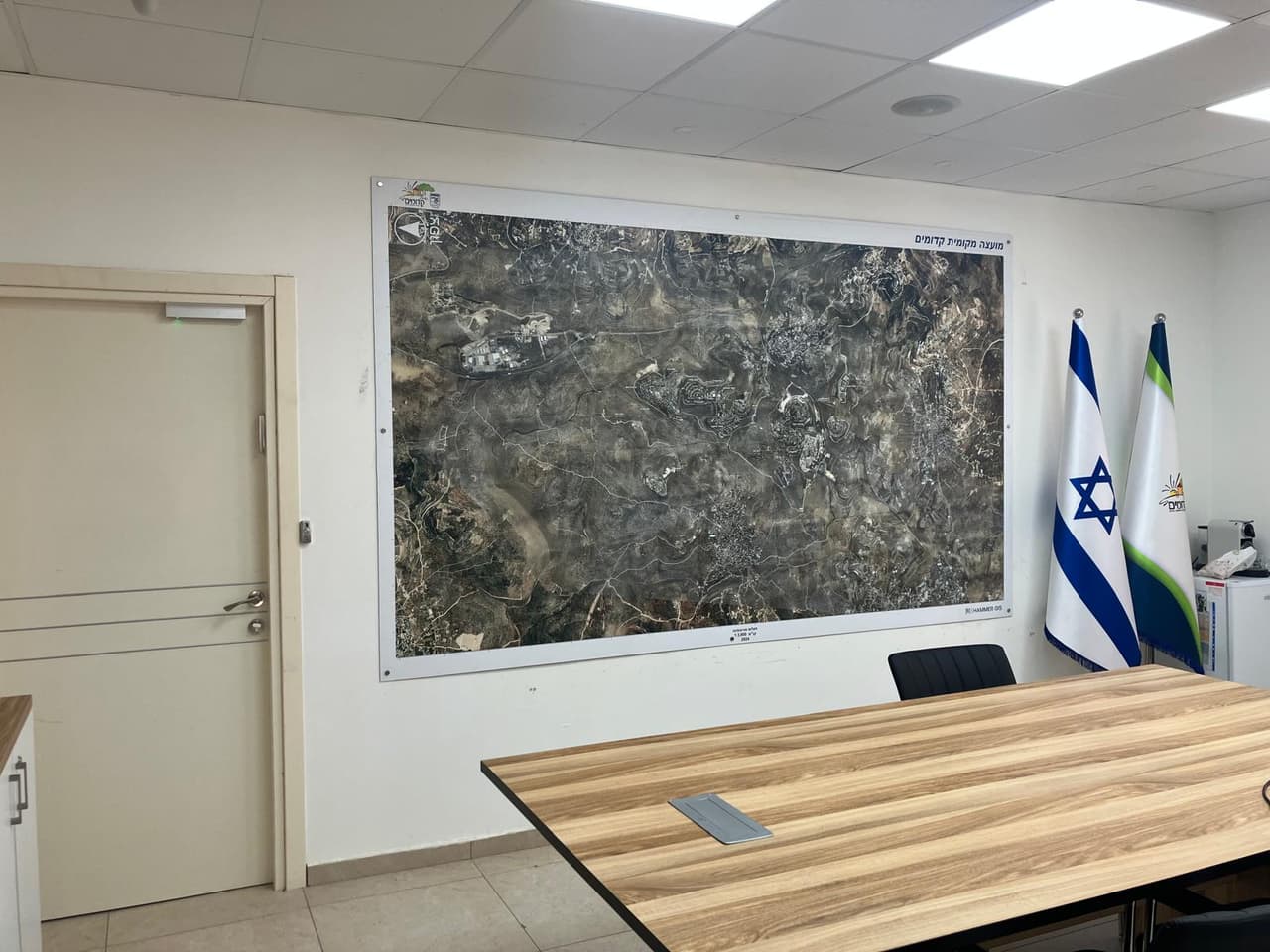
Aerial wall maps for council offices
Wall-sized aerial photo maps with boundaries and base layers for meeting rooms, offices and waiting areas.
How we show our work
Evidence, not slogans
What you see here is real project output: a layer, a map, a dashboard or a report.
Most of our clients are local authorities and public bodies, so we name them only with written approval. Until then, a project is described by client type, such as "a local authority" or "a regional council", and identifying details are removed from the images. Illustrative material is labelled as such and never presented as project output. Numbers appear only when they were measured and checked, as in the CADabra quality report.
- Source and dateEvery project carries a data strip with the source, the date and the coordinate system where they are known.
- Names with approval onlyAn authority or organisation is named only after written approval to publish.
- Illustrations labelledIllustrative material is marked "concept visualization, illustrative data" and never shown as project output.
Frequently asked questions
Why are client names missing from some projects?
Most of our clients are local authorities and public bodies. We name a client only after written approval; until then we describe the project by client type and remove identifying details from the images.
Can I see a demo of one of the systems?
Yes. We can book a demo of HAMMER CITY or CADabra on demo data, and show examples from past surveys without identifying client data.
What formats do you deliver in?
GIS layers loaded into the client's ArcGIS Online or another system, plus DWG, Excel and PDF files, dashboards and apps as needed. Every project is documented with its data source and date.
Your next project
What do you want to move forward in your organisation?
Tell us what needs solving and we will come back with a proposed approach: a survey, a system, software, or a combination.